
Files
Download Full Text (3.1 MB)
Description
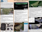
The Eagle Lake Dam is an iconic part of Morehead State’s campus. It can be seen from much of campus and serves as one of the best views around. It is also the single most important structure on campus. A significant percentage of the campus would be damaged or impaired, as well as many people would be endangered if the dam failed. Hence, I am starting a multi-person and multi-year initiative to monitor Eagle Lake Dam using UAV and remote sensing technology. I hope to have teams make annual 3D models of Eagle Lake Dam over the next several years to monitor changes. This poster documents my method for doing this, so that others can do the same and compare their found data to my own. I also showcase several different ways to use this technology to create useful products and motivate others to learn about this cutting-edge technology.
Publication Date
4-2022
Disciplines
Arts and Humanities | Business | Education | Engineering | Higher Education | Life Sciences | Medicine and Health Sciences | Physical Sciences and Mathematics | Social and Behavioral Sciences
Recommended Citation
Sparks, Nathan and Hare, Timothy, "Drone Mapping on Eagle Lake Dam" (2022). 2022 Celebration of Student Scholarship - Poster Presentations. 14.
https://scholarworks.moreheadstate.edu/celebration_posters_2022/14
Included in
Arts and Humanities Commons, Business Commons, Engineering Commons, Higher Education Commons, Life Sciences Commons, Medicine and Health Sciences Commons, Physical Sciences and Mathematics Commons, Social and Behavioral Sciences Commons